When you think of Antarctica and the dangers associated with it, people tend to only think of the brutal weather. However, the risks don’t stop there; many of the greatest dangers come from what lies beneath the icy landscape. At places like Troll Station, a Norwegian research base, scientists have to navigate surfaces that may look stable, but conceal deep crevasses and other dangerous ice features. Traveling across this terrain is extremely risk and it’s a risk that many polar scientists take, knowing that one misstep can lead to disaster.
When I first started at the ESR program, I had some familiarity with glaciers due to studying for the Science Olympiad. Ice sheets, ice shelves, and crevasses were terms that I recognized. However, the ESR program took this basic understanding that I had and turned it into tangible research with a possible real-world impact. Through work with satellite data and guidance from mentors, I was able to develop essential research skills that will apply to my career.
My project was focused on improving the safety of travel through Troll Station (-72, 2.53) which sits south of the Fimbul Ice Shelf. I analyzed the changes in the ice surface from 2019 to 2025 through the use of two datasets from NASA’s ICESat-2 (acronym for Ice, Cloud, and land elevation satellite). ICESat-2 is lazar altimeter influential in tracking ice elevation.
The first dataset, ATL11, provided surface elevation along a track, while the second dataset, ATL15, gave gridded data on the change of elevation over time. By analyzing this data, I could identify areas where there was significant variability, an indication of unstable areas where scientists should avoid.
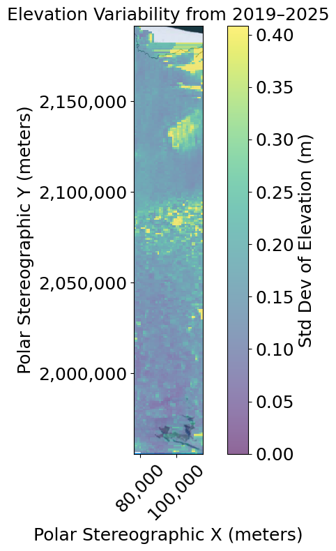
This is the graph of the elevation variability between 2019 and 2025. In this graph, there are several areas that are constantly changing, while some other areas remain stable. The colors like yellow represent the areas that have more change, while colors like purple represent areas that are stable. For scientists in this region, this information is crucial. Through the identification of lower variability zones, they can plan safe routes between the Fimbul Ice Shelf and Troll Station. I used ATL15 for this graph as the gridded data was necessary to do this.
Ultimately, this experience showed me that even as a high school student, I can contribute to real scientific work. I started with an interest in glaciers, and through the ESR program, I was able to take this interest and turn it into meaningful research. I have strengthened my research skills, and ESR has given me the confidence to work in research throughout college and beyond.
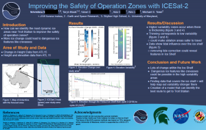
Find out more of my work by viewing my poster: