
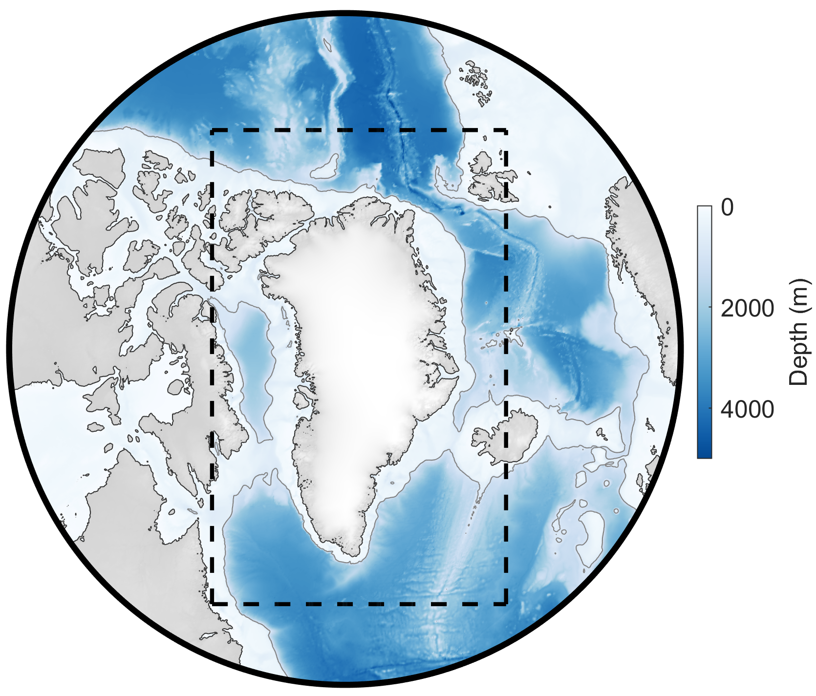
Domain for Greenland 1 km tide model (dashed black line); grid is idealized polar stereographic with uniform spacing of 1 km. Color scale shows depth (in meters).
Model and Software Summary
| Build Date: | 2021 |
| Model type: | Forward (dynamics-based), barotropic (depth-integrated) |
| Grid: | 1-km uniform idealized polar stereographic |
| Constituents: | M2, S2, N2, K2, K1, O1, P1, Q1 |
| Units: | z (surface height; meters); u,v (currents; cm/s); U,V (transports; m2/s) |
| Coordinates: | Currents and transports are in East (u,U) and North (v,V) components |
| Downloads: | Arctic Data Center doi:10.18739/A2251FM3S. |
| Citations: | Howard, S. L., & Padman, L. (2021). Gr1kmTM: Greenland 1 kilometer Tide Model, 2021. Arctic Data Center. doi:10.18739/A2251FM3S. |
Additional notes: The Greenland 1 kilometer Tide Model (Gr1kmTM) is a barotropic ocean tide model on a 1 km x 1 km polar stereographic grid, developed using the Regional Ocean Modeling System (ROMS). Gr1kmTM consists of spatial grids of complex amplitude coefficients for sea surface height and depth-integrated currents (“volume transports”) for 8 principal tidal constituents: 4 semidiurnal (M2, S2, K2, N2) and 4 diurnal (K1, O1, P1, Q1). Model bathymetry is based on IceBridge BedMachine Greenland, Version 4 (Morlighem et al., 2021) merged with the global GEBCO_2020 grid (GEBCO Compilation Group, 2020) to fill in outer regions of domain. A high resolution (100 m) coastline file from J. Mouginot (Rignot and Mouginot, 2012) was used to define the Greenland land mask but was extended inshore to the grounding lines of the largest remaining Greenland ice shelves (Petermann, Steensby, Ryder, 79 N, Zachariae Isstrøm, Storstrømmen, and Rink Isbræ) based on the Greenland Bedmachine Version 4.
Contact Susan Howard or Laurie Padman for advice about the use of this model.