
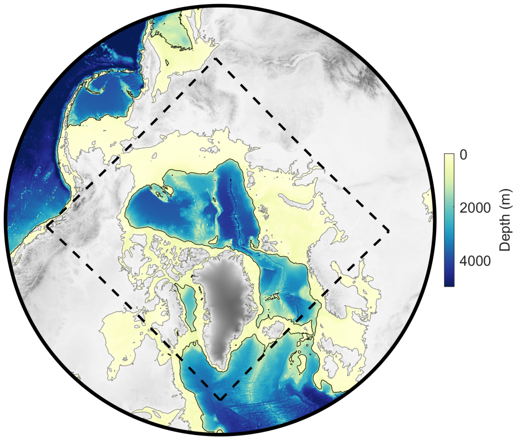
Domain for Arc5km2018 tide model (dashed black line); grid is idealized polar stereographic with uniform spacing of 5 km. Color scale shows depth (in meters).
Model and Software Summary
| Build Date: | 2018 |
| Model type: | Inverse (data assimilation) and Forward (dynamics-based), depending on constituent; barotropic (depth-integrated) |
| Grid: | 5-km uniform idealized polar stereographic |
| Constituents: | M2, S2, N2, K2, 2N2, K1, O1, P1, Q1, M4, MS4, and MN4 |
| Units: | z (surface height; meters); u,v (currents; cm/s); U,V (transports; m2/s) |
| Coordinates: | Currents and transports are in East (u,U) and North (v,V) components |
| Downloads: | Arctic Data Center doi:10.18739/A21R6N14K. |
Additional notes: Ar5km2018 is an updated version of AOTIM5. The solution was significantly improved by using new open boundary conditions (TPXO9.v1 elevations), leading to substantial improvements for the constituents where no data assimilation is used (N2, K2, P1, and Q1). Non-linear constituents – M4, MS4, MN4, and 2N2 – were added to the model, with no data assimilation.
We expect the performance of the updated version (2018) to be superior to the legacy version (2004). However, we recommend that the user compare both models, and letting us know how they compare for specific applications, as this will guide further model developments.
Contact Laurie Padman for advice about the use of this model.