
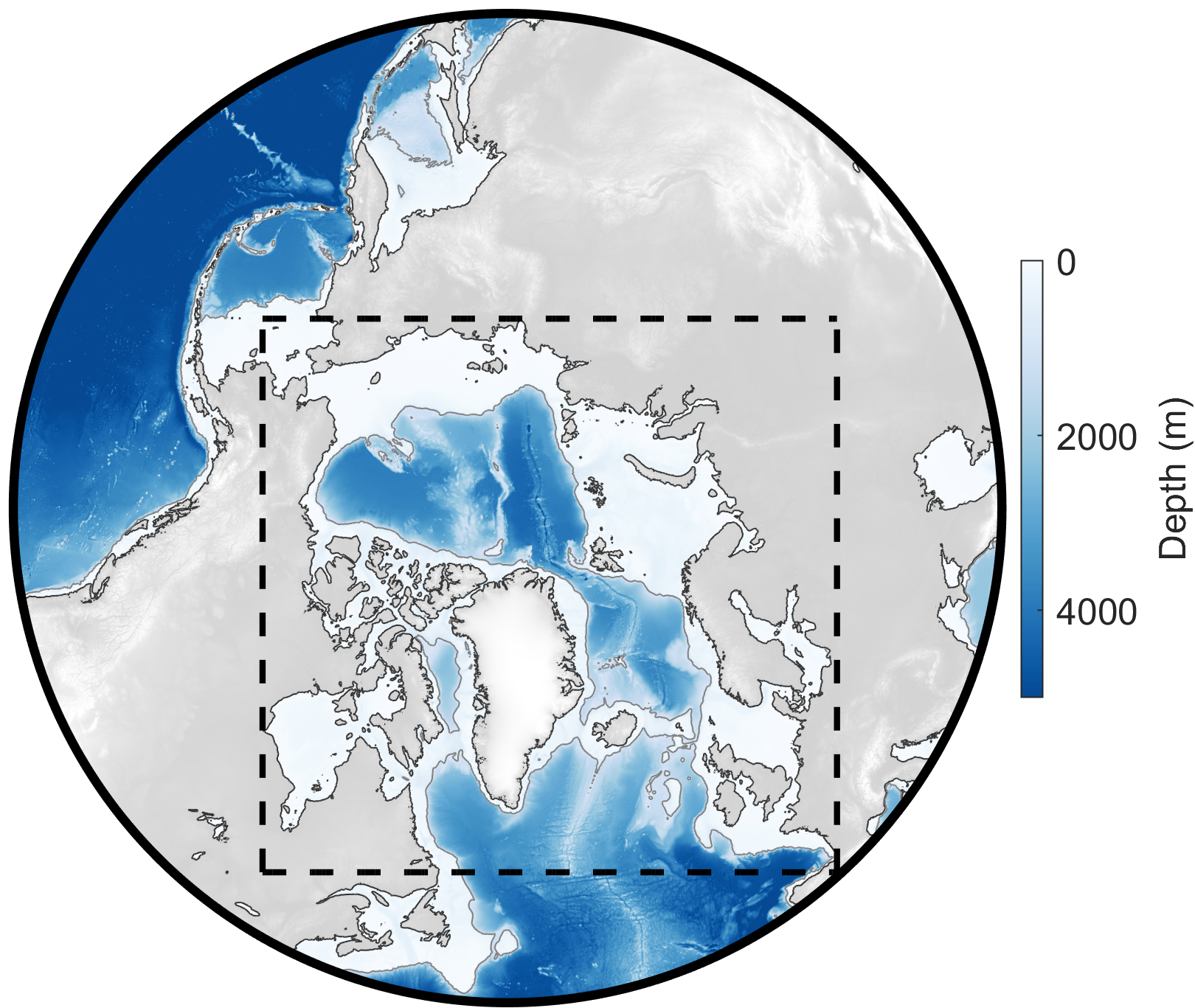
Domain for Arctic 2 km tide model (dashed black line); grid is idealized polar stereographic with uniform spacing of 2 km. Color scale shows depth (in meters).
Model and Software Summary
| Build Date: | 2021 |
| Model type: | Forward (dynamics-based), barotropic (depth-integrated) |
| Grid: | 2-km uniform idealized polar stereographic |
| Constituents: | M2, S2, N2, K2, K1, O1, P1, Q1 |
| Units: | z (surface height; meters); u,v (currents; cm/s); U,V (transports; m2/s) |
| Coordinates: | Currents and transports are in East (u,U) and North (v,V) components |
| Downloads: | Arctic Data Center doi:10.18739/A2PV6B79W. |
| Citations: | Howard, S. L., & Padman, L. (2021). Arc2kmTM: Arctic 2 kilometer Tide Model, 2021. Arctic Data Center. doi:10.18739/A2PV6B79W. |
Additional notes: The Arctic 2 km (kilometer) Tide Model (Arc2kmTM) is a barotropic ocean tide model on a 2×2 km polar stereographic grid, developed using the Regional Ocean Modeling System (ROMS). Arc2kmTM consists of spatial grids of complex amplitude coefficients for sea surface height and depth-integrated currents (“volume transports”) for 8 principal tidal constituents: 4 semidiurnal (M2, S2, K2, N2) and 4 diurnal (K1, O1, P1, Q1). Model bathymetry is based on the 2014 30 arc-second General Bathymetric Chart of the Oceans (GEBCO_2014) grid. Based on more recent fieldwork, we revised the bathymetry for our model in three key regions around Greenland: Northeast Greenland, Petermann Fjord and adjacent area of Nares Strait, and the Northwest Greenland coastal region. A high resolution (100 m) coastline file from J. Mouginot (Rignot and Mouginot, 2012) was used to define the Greenland land mask, with adjustments for the Petermann ice shelf. Other ice shelves in Greenland are not included in Arc2kmTM but are included in our Greenland 1 km Tide Model (Gr1kmTM).
Contact Susan Howard or Laurie Padman for advice about the use of this model.