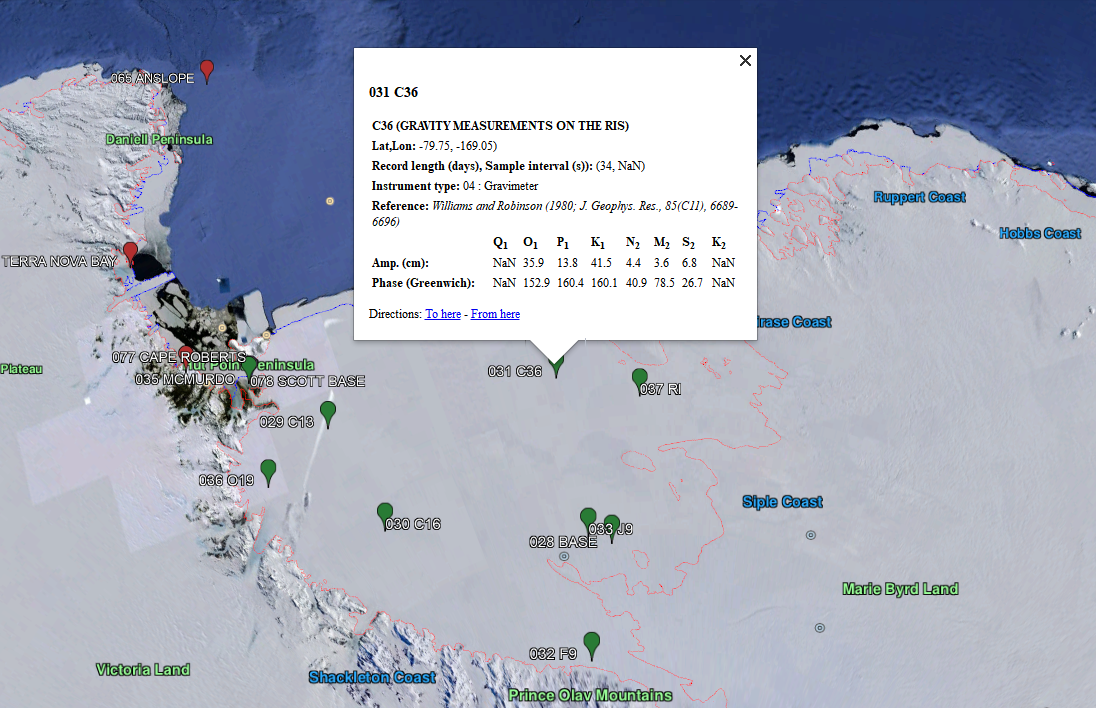
ESR has developed a set of KML files to be used with the Google Earth App. By installing Google Earth, and downloading our set of *.kml files, you can access the AntTG interactively. The package contains 3 KML files: the tide gauge data, and grounding line and ice-shelf front boundaries developed from the Antarctic land/ice/ocean mask file by Geir Moholdt (Norwegian Polar Institute); see Depoorter et al. (2013). Icons used by the tide gauge data file are also included.
Depoorter, M.A., Bamber, J.L., Griggs, J.A., Lenaerts, J.T.M., Ligtenberg, S.R., Van den Broeke, M.R. and Moholdt, G., 2013. Calving fluxes and basal melt rates of Antarctic ice shelves. Nature, 502(7469), p.89.
Downloads
The AntTG KML package can be downloaded from the USAP data center: https://www.usap-dc.org/view/dataset/601358
You will also need to download and install the Google EARTH App
Contact: Please contact Susan Howard if you have trouble with this package, or have suggestions for improving it.