Home > What We Do > Research > High-Performance Computing
Scientists at ESR use high performance computing (HPC) systems through NSF and NASA funded centers to solve a variety of earth science problems. Using these facilities expands their research horizons in new and exciting ways. ESR scientists also embrace cloud computing environments for accessing and processing the massive datasets provided by NASA and other space agencies. By utilizing the CryoCloud infrastructure, we can easily collaborate with other researchers and reduce the need to download data.
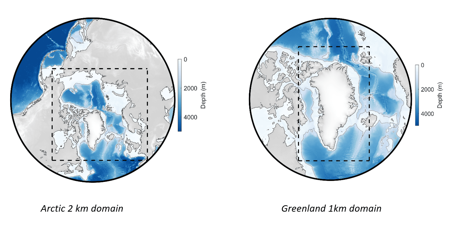
Using NSF’s systems, ESR researchers developed high resolution models of tides in polar regions, including our 1 km Greenland Tide Model, and our Arctic 2 km Tide Model. High resolution models are important as we try to obtain accurate tide predictions within fjords and close to the coastline in the Arctic and Antarctic. These models solve depth-averaged equations to create maps of tide heights and depth-averaged currents. In some cases, however, tidal currents can vary significantly with depth, with important effects on ocean mixing and other forecasting needs. HPC systems have also allowed us to make the first high-resolution map of how tidal currents vary with depth in the Arctic Ocean.
Find out more about these models on our Arctic Tides portal at the Arctic Data Center.
HPC systems have allowed ESR researchers to run high-resolution models of how the ocean interacts with Antarctica’s sea ice and ice shelves. Our scientists have used these models to explore topics such as: how tides affect mass loss by basal melting of ice shelves, how sensitive the models are to seabed shape under ice shelves (which is poorly known because it is difficult to measure), and why the ice shelf melt rates vary seasonally.
See some movies we have made to show modeled ocean flows under the massive Ross Ice Shelf.
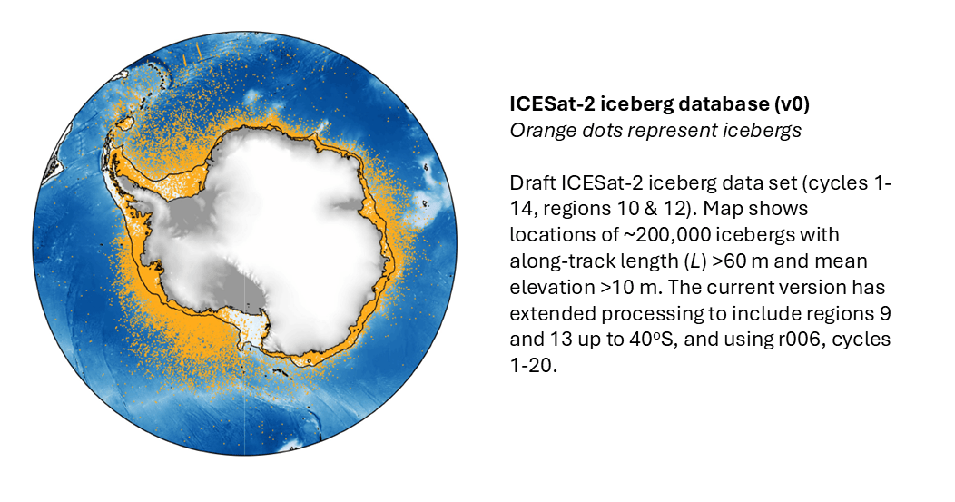
ESR worked with NASA’S SlideRule team to spin up private clusters to process several hundred terabytes of ICESat-2 single-photon data by utilizing their on-demand processing system. By processing all granules around Antarctica, we are able to create a seamless new product with the resolution and surface classification algorithm that best suits our study needs. Our scientists are then using this product to create an Antarctic Iceberg Database which saves height information for crossings of all detected icebergs, which is a new exciting addition to iceberg science.