Home > What We Do > Research > Cryosphere
The term “cryosphere” refers to the areas on earth where water can be found in frozen form, such as snow, ice and permafrost. ESR researchers have a wide range of interests and expertise in polar studies and ice and snow science, including the atmosphere and ocean tides in the Arctic and Antarctic, ice sheets and glaciers, snow, sea ice, and icebergs. And we study how all these things interact to create and regulate the climate we experience on this planet.
Tides can have dramatic impacts on the world’s oceans by changing sea levels and generating sometimes dangerously strong currents. ESR researchers focus on understanding tides and their effects in the polar oceans. Tidal currents increase mixing of heat, salt and nutrients up and down the water column to affect ocean stability, sea ice distributions, ice shelf basal melting, and surface mixed layer ecosystems. We develop tide models for both the Arctic region and seas around Antarctica, analyze satellite-derived measurements of sea surface height and ice shelf height changes, and contribute to databases of polar ocean tide heights and currents.
Movie showing motion of Ross Ice Shelf (green) and nearby ocean (blue) from tides. Tan shows underlying seabed. Developed by Laurie Padman, ESR.
Find out more about ESR’s work on tides:
Seasonal snow and firn (i.e., snow that lasts more than one year) are keystone elements of the Earth System. Snow and firn store water for ecosystems and economies, influence surface temperatures through thermal insulation and reflection of sunlight, and record the history of past climates. ESR scientists study snow and firn and the stored histories in impactful and vulnerable areas like the Cascade Mountains in the US Pacific Northwest, and the Greenland and Antarctic ice sheets.
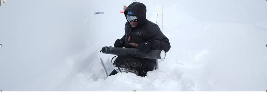
Find out more about ESR’s work on snow and firn:
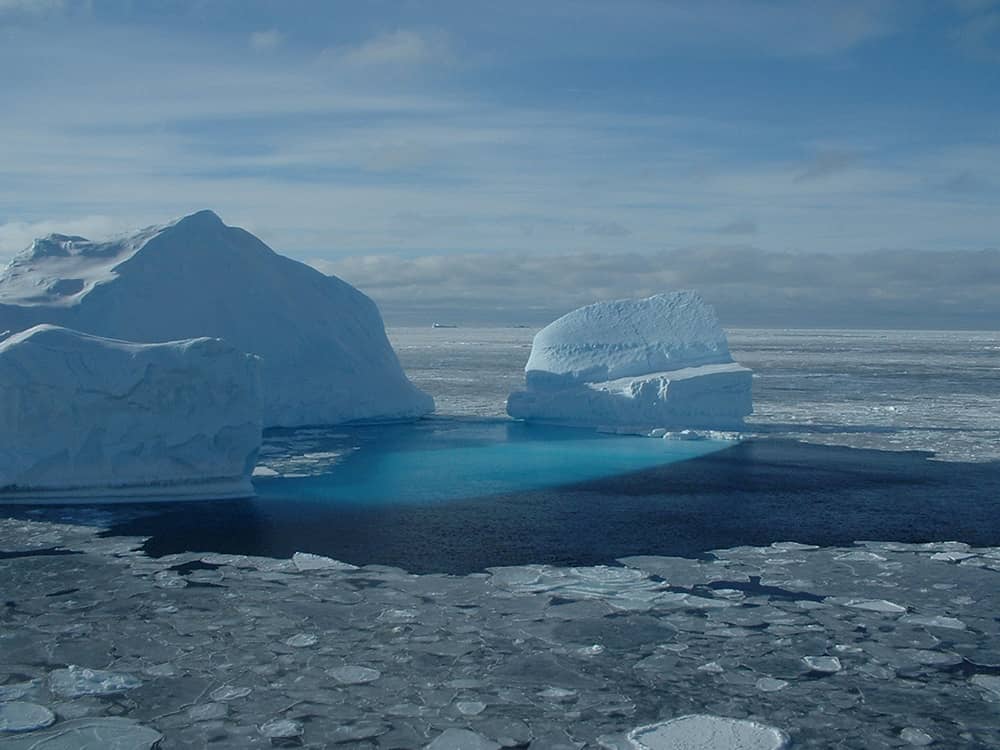
Almost half the mass loss in Antarctica occurs through iceberg calving. Our scientists use several satellites (ICESat-2, Sentinel-1, Vantor Worldview, and Surface Water Ocean Topography ( SWOT)) to look at the rifts (cracks in ice shelves and glaciers) that lead to iceberg formation, and to find icebergs, measure their sizes, and work out whether an iceberg is floating, has run aground, or is trapped in landfast sea ice. We use grounded icebergs to estimate water depth, which is valuable information around Antarctica where depth measurements from ships are difficult to get because of distance from ports, harsh weather and thick sea ice. We also study high-resolution satellite data to improve our understanding of how icebergs affect where landfast sea ice forms, and how icebergs decay.
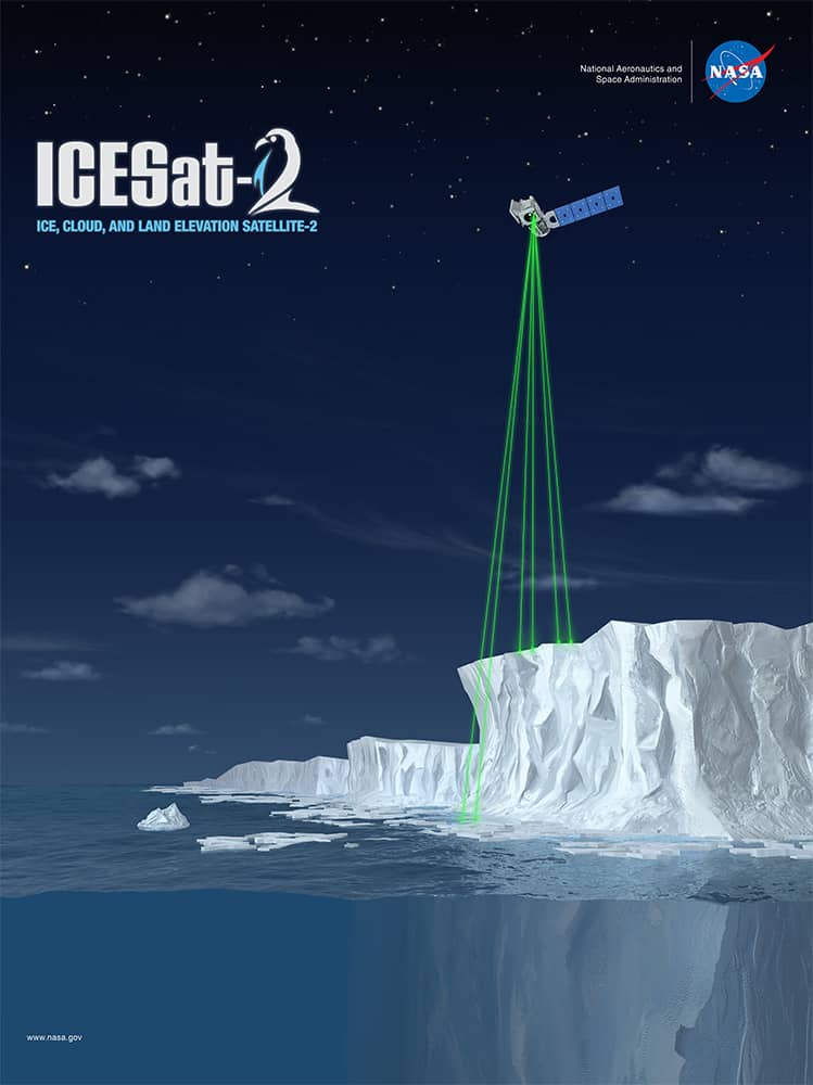
Ice shelves, which occur where glaciers around Greenland and Antarctica flow into the ocean and start to float, play critical roles in stabilizing ice sheets and how they respond to changing ocean and atmospheric conditions. ESR scientists play key roles in measuring and understanding long-term changes in ice shelves, including identifying the roles of tides, and pathways for warm water circulating under ice shelves that affect ice loss through melting. Our scientists also use two currently active satellites, the NASA/CNES Surface Water and Ocean Topography (SWOT) mission and NASA’s ICESat-2 laser altimeter, to examine ice shelf processes at small scales, including surface and basal mass changes, changes in crevasses and rifts, and ice flexure in grounding zones and along ice shelf fronts.
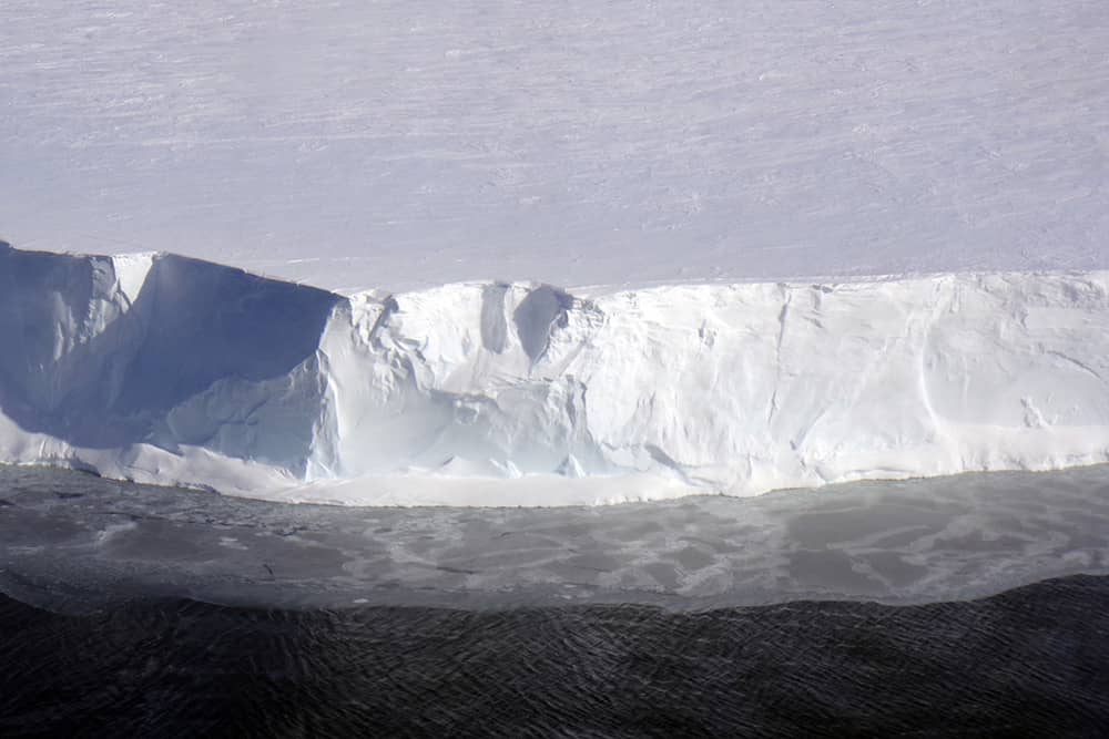
Sea ice forms, grows, and melts in salty ocean water. This sets it apart from other forms of ice like icebergs, glaciers, and lake and river ice that form from fresh water. It is a critical component of Earth’s climate, changing the reflectivity of the Earth surface and acting as an insulator between cold polar atmospheres in winter and the warmer ocean underneath. Sea ice also provides critical habitat for numerous polar species, from plankton to krill up to penguins and seals. ESR scientists have engaged in research into several aspects of sea ice. Our current focus is on using satellite altimeters to measure properties of landfast sea ice, including thickness and roughness, around Antarctica. From these measurements we hope to work out how grounded icebergs affect the set-up of landfast sea ice, which then changes how the atmosphere affects the ocean temperature and circulation around and under ice shelves. Predicting future changes in Antarctica will require understanding the feedbacks between processes in the sea ice, ice shelves, oceans and atmosphere.
Movie showing the growth and decay of Antarctic Sea Ice from 2010-2015. Green areas are ice shelves.
Created by Laurie Padman, ESR.
The atmosphere and clouds in the cryosphere present unique phenomena to understand. It is tricky to predict heat transfer over cold and icy surfaces and model the existence and impact of super-cooled and mixed-phase (ice and liquid water) clouds over polar ice sheets. Microclimates in complex terrain like the coast of East Antarctica represent unique zones, critical to understanding whether and how Antarctica accumulates or releases snow and ice. These phenomena are not only fascinating but are areas of active research in polar meteorology and climatology. ESR scientists are actively engaged in better understanding these aspects of the cryosphere through development and deployment of state-of-the-art high- and medium-powered cloud and atmospheric observatories in remote polar regions, as well as development of systems to characterize the microclimates regulating energy and moisture transport in complex terrain.
Find out more at: